
Washington County ZIP Code Coverage
The inventory below is a representative Washington County view of the 2020 Census ZCTA-to-county-intersection baseline. It is not a claim of USPS delivery coverage, a list of post-office service areas, or proof that every address in a listed ZCTA lies in the county. The baseline predates the 2026 introduction of 97129. Use the USPS address tool for a real mailing address, then confirm the parcel and jurisdiction locally.
| ZIP | Areas | Post Office | Notes |
|---|---|---|---|
| 97003 | Beaverton-area postal geography | Not established by this ZCTA baseline | County-intersection geography; verify the parcel. |
| 97006 | Beaverton/Hillsboro postal geography | Hillsboro or Beaverton postal recognition | USPS recognizes both names in the City’s documented example. |
| 97007 | Beaverton and southwest county geography | Not established by this ZCTA baseline | Do not infer municipal limits from the ZIP. |
| 97078 | Aloha/Beaverton-area geography | Not established by this ZCTA baseline | Use the parcel to determine jurisdiction. |
| 97113 | Cornelius-area geography | Not established by this ZCTA baseline | ZCTA intersects Washington County. |
| 97116 | Forest Grove-area geography | Not established by this ZCTA baseline | ZCTA intersects Washington County. |
| 97123 | Hillsboro-area geography | Not established by this ZCTA baseline | Some delivery addresses changed to 97129. |
| 97124 | Hillsboro-area geography | Not established by this ZCTA baseline | ZCTA intersects Washington County. |
| 97229 | Portland, Bethany, and Cedar Mill-area geography | Not established by this ZCTA baseline | Postal city does not control county jurisdiction. |
| 97129 | New Hillsboro delivery geography | Hillsboro | USPS code effective July 1, 2026; absent from the 2020 baseline. |
The complete Census relationship file includes 32 intersecting ZCTAs. That count is useful for geographic research, but it should not be turned into a blanket mailing claim. ZCTAs such as Lake Oswego-, Scappoose-, Newberg-, Wilsonville-, Tillamook-, and Portland-area geographies can intersect the county without making their postal labels a countywide locality description.
Washington County ZIP Geography Baseline
A ZIP is a USPS delivery geography, not a legal boundary for a city, county, parcel, voter precinct, or school service area. Washington County combines built-up Portland-metro communities with western rural communities, so the same research trail may contain a city name, a postal label, a county grid reference, a tax lot, or a Donation Land Claim description. Each label can be valid for its record purpose without identifying the same boundary.
The USPS ZIP Lookup is the delivery-address check. It answers the postal portion first. The county parcel check comes second, because a USPS result does not show whether an address is inside Hillsboro, Beaverton, another municipality, or unincorporated Washington County. This USPS-to-InterMap sequence avoids using a postal label as a jurisdiction decision.
Washington County 97129 ZIP Code Change
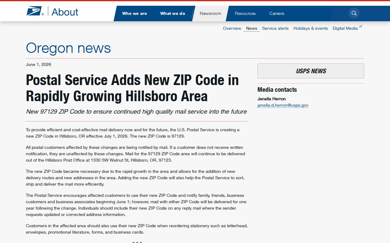
USPS and the City of Hillsboro state that ZIP 97129 became effective July 1, 2026 for more than 10,000 Hillsboro addresses. The published general boundary runs from Cornelius Pass Road to Brookwood Parkway and from Main Street to Rosa Road and Murphy Road. USPS encouraged address updates beginning June 1, 2026 and accepts mail using either the former or new ZIP through July 1, 2027. This is a delivery change, not a revised city limit or a change to a deed’s legal description.
The USPS release on the 97129 rollout is the source for the image below. The release identifies the transition period and supports treating a former 97123 address and a current 97129 mailing form as records that may refer to the same place.
When a Washington County ZIP code search turns up an older document, retain both postal forms with the document date. A parcel, tax lot, and legal description offer more stable links across a postal reassignment.
Washington County ZIP and City Mismatches
ZIP 97006 shows the local mismatch clearly. Hillsboro says USPS recognizes both Beaverton and Hillsboro for 97006, and the City directs its applicable addresses to use Hillsboro. That postal recognition does not establish which city governs a permit, assigns an address, or supplies municipal records. A county-intersection ZIP near Portland, Tualatin, Tigard, or Wilsonville presents the same basic caution: use the physical parcel rather than the postal city to identify the record custodian.
Current boundary work needs current maps. Survey Explorer’s section maps omit property-boundary and city-annexation changes after April 25, 2012. Consult current InterMap or municipal GIS for the present line, while using those historic section maps for plat, road, corner, and land-description context. A city-limit mismatch is often a records-geography issue, not an error in the address.
Washington County ZIP Directory Terms
Postal terms describe routing. County land records describe a place differently. Keeping the terms below separate prevents a mailing reference from being mistaken for ownership or residence evidence. No local PO-box-only status is asserted here because the inspected Washington County sources did not verify one.
- ZIP
- A USPS delivery-routing code used with a mailing address. It is not a parcel or municipal boundary.
- ZIP+4
- An added four-digit delivery segment used by USPS to refine routing beyond the five-digit ZIP.
- PO-box ZIP
- A ZIP associated with post-office-box delivery. Whether any particular local code has that status must be confirmed with USPS.
- Carrier route
- A USPS delivery grouping within a ZIP area. It is a postal-routing term, not a verified county property-search field.
For a deed or assessment record, the related land terms are situs address, tax lot or R number, and legal description. The tax mailing address can be outside the property ZIP, city, or state, because it identifies the party responsible for receiving the tax statement rather than the physical property location.
Find By Washington County ZIP Code
No local government portal inspected for this research offers a verified ZIP-wide resident or property search. That limitation changes the correct workflow. Use the mailing ZIP to validate a known address, then use the physical address to locate the parcel. Do not claim a countywide list from a postal code alone, and do not treat a map or tax-mail contact as a complete household record.
- Confirm the delivery ZIP for the complete mailing address through the USPS lookup, especially when the document predates the 97129 transition.
- Enter the physical address in Washington County InterMap and record the tax lot or R number returned by the parcel result.
- Open Assessment & Taxation Information to review the property, sales/deed, value, and improvement categories tied to that parcel.
- Check whether the parcel is within a city or unincorporated county territory before using a city permit route or county planning channel.
- Use Recording Office documents, library sources, or a records request only for the separate question each custodian can answer.
Once a postal area narrows to a specific address, the Washington County street directory route is the appropriate address-by-address workflow. It explains the parcel, recording, permit, and historical-directory channels without presenting ZIP geography as an address list.
Washington County Parcel Search Fields
InterMap’s verified fields are address and parcel identifiers, not postal filters. The county instructions name Situs Address, Tax Lot ID, and R number as the three lookup keys. After a selected map location, Additional Information leads to Assessment & Taxation Information. The static property-search page exposes a general input, but no inspectable ZIP option was verified. OJD search is name, case, and court oriented; the county voter-data form lists district, precinct, and county filters but not ZIP.
| County field | Type | Required | ZIP-directory use |
|---|---|---|---|
| Situs Address | Text/address lookup | One lookup key | Use after USPS confirms the delivery address; no ZIP filter is verified. |
| Tax Lot ID | Text identifier | One lookup key | Locates a known county parcel; not a postal search. |
| R number | Text identifier | One lookup key | Locates a known assessment reference; not a postal search. |
| Additional Information | Map-result panel | After map selection | Opens the assessment-report route, not a ZIP-wide result. |
| Assessment & Taxation Information | Subreport command | No | Shows property, sales/deed, value, and improvement categories. |
This documented absence is useful. It prevents a postal search from being presented as a county property filter and directs the researcher to the correct next step: verified delivery address first, county parcel second.
Washington County Address Continuity
Hillsboro’s 2015 through 2020 Connecting Hillsboro work combined former City and County addressing systems. The City reported about 44,000 City-grid addresses and 11,000 County-grid addresses at the start. Old and new forms remained valid for one year for individuals and two years for businesses, while USPS was notified. A postal ZIP and a street address can both change over time, so preserve the old form, new form, phase, and document date before deciding records conflict.
Inside Hillsboro, City Planning assigns addresses and uses a grid centered on First Avenue and Main Street. For unincorporated territory and certain cities, County Development Review approves street names and addresses. The Hillsboro address-project history and City addressing information provide the local continuity route before a ZIP-based search is treated as incomplete.
Washington County ZIP Directory Limits
A Washington County ZIP code directory can organize postal geography, but it cannot prove who owns a parcel, who lives at an address, where a person receives all mail, or which city has jurisdiction. Property tax records keep the physical situs, legal description, and tax-mail contact distinct for good reason. Protected addresses remain protected, and a nonpublic result is a boundary rather than a problem to solve through another source.
The sound local sequence remains simple: USPS for delivery form, InterMap for the parcel, then the county or municipal custodian for a defined record question. It respects Washington County’s overlapping postal, city, county, and land-record geographies. Save both the delivery form and the parcel identifier with the date checked.